
The essential
solution for professional surveyors
|
|
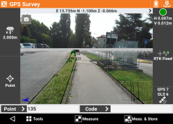
Augmented Reality View
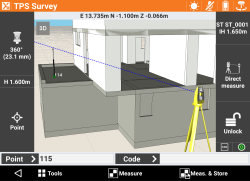
BIM View
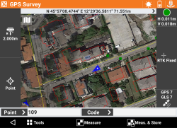
Web background View |
X-PAD Ultimate is your
field software solution to efficiently leverage the power and
connectivity of standard Android devices with modern, mature, complete
and fully functional data collection software.
X-PAD Ultimate Survey is
the best solution for all design survey, property survey, and layout
needs. Combining data collection from GeoMax / iGage / other instruments
X-PAD provides you with complete survey features, data integration, scalability
and the latest technology – X-PAD covers all your field collection
needs.
|
If you are interested in X-PAD don't hesitate
to call us and get a free 30-day demo. It will run well on any
Android device, you can checkout all of the functions using the GPS
receiver in the Android device, or the Total Station emulator.
|
|
Optional Robotic, X-Pole
optical + GNSS, GIS, Volume, BIM, Locator, Bathometry, advanced Roading,
PicPoint measurements from photos and BIM modules extend your survey
investment to optimize complex workflows.
Android based data
collectors just provide a superior field platform:
- rugged tablets and phones,
hardened cases, easy replacement and availability
- heavy-duty, reasonably priced,
obtainable pole
brackets
- check out these [
Customer
Designed Solutions ]
- quick charging, extreme battery
life, standard cables
- brighter, higher resolution,
higher contrast, outdoor viewable screens with the best capacitive touch
screens
- superior connectivity via built-in
cellular connections, automatic data uploads to the cloud
- the highest quality internal
cameras
- modern phones have superior
Bluetooth for extended long-range connections to robots. Twice the
range of dedicated Windows Mobile devices, as far as 2,000 feet: [
Google
Pixel 4a Robotic Bluetooth Range Video ]
- amazing eco-system of Android
helper apps and tools available from the Google Play Store
- no forced, slow system updates
that repeatedly keep you from working
- no obsolete and depreciated
connection schemes (Windows Mobile Device Center)
- browse to secure web resources
- internal mapping grade GNSS
receivers (built into the phone) allow for recon without RTK or
Robotic deployment
- extensive web-based background
maps
X-PAD's included office component
X-PAD Fusion adds additional data
import/export support and can be extended to support Point Clouds,
terrestrial and drone-based photo
management and stitching. |
X-PAD Brochures, User Manuals, Getting Started Guides
|
| |
|
X-PAD X-PERT Maintenance
|
|
 |
Reasonably
priced X-PERT maintenance ($250 / Year) keeps your X-PAD software
updated to the latest version with the latest features and enhancements.
One year's maintenance is included with
the initial purchase, up-to three years extension can be added.
Expired
maintenance can be retroactively extended for up to one year.
[
Maintenance Discussion
|
X-PAD Demos
|
|
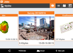
Job Selectionn
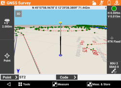
3D View |
Fully functional, 30-day
X-PAD demos are available.
Quick and easy to install on your existing
Android device, the demo can later be converted to a licensed copy by
simply adding a license number.
First, call or contact
iGage for a demo serial number:
+1-801-412-0011
orders@igage.com
This short [
Demo FAQ ] will help you activate the demo.
Next, these detailed iGage
Getting-Started Guides will quickly lead you through installation,
localization and deployment:
GPS: Page 6 of
[
X-PAD Getting Started with GNSS ]
Total Station: Page
3 of
[
X-PAD Getting Started with Zoom 90 Robotics
]
Finally, this short
video will show you all the steps (from the Getting Started guides) for getting started:

|
X-PAD Pricing
|
|
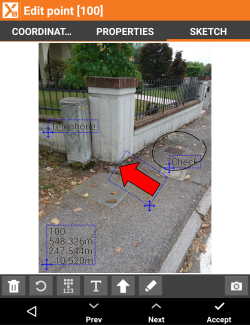
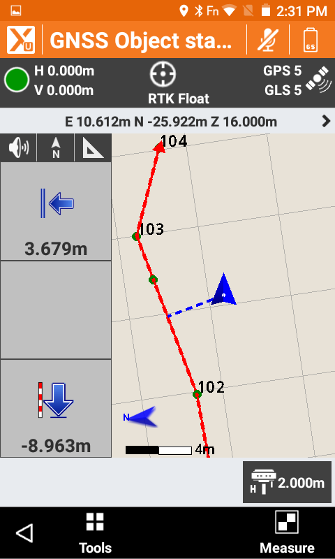
Measurement Markup
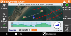
Bathymetric Survey Option
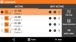
Multiple Feature Stacking
|
X-Pad is competitively
priced (updated 4/1/2025)
(click [ field
software comparison ] for price and feature comparisons): |
X-PAD Ultimate
Survey Pricing
please call for quotations and bundles |
|
Cross-grades
from other field tools are available, please call. |
|
GNSS:
Support for
GPS receivers #963978 (checkout the Premium package below) |
$
1,200 |
|
TS:
Manual Total
Station #963980
(checkout the Premium package below) |
$
1,200 |
|
Robotics (add to TS)
Extend the TS
main module with features that allow full control of
motorized and robotic total stations. Includes MEP
functions. #964020
(checkout the Premium package below) |
$
475 |
|
Roading
Import road
design data from different formats, stakeout any element in
the alignment with a variety of methods. #964026 |
$
445 |
|
Automeasuring
Automate
repetitive robotic measurements and web-SMS-Email reporting
for monitoring applications. #964021 |
$ 1,620 |
|
Volume
Create and
import 3D surfaces to be used for all stakeout operations.
It includes functions for the calculation of the volumes
according to different methods. #964023 |
$
445 |
|
Bathymetry
Manage
bathymetric surveys by acquiring depth data from echo
sounder and GNSS positions. This includes a route control.
#964024 |
$
925 |
|
X-Pole
Requires TPS+ROBOTICS+GNSS modules |
$ 445 |
|
BIM
Allows to
import and manage 3D IFC model files. Elements to layout can
be isolated then data can be extracted for the stakeout.
Tools to compare directly on the field design with as-built
are included. |
included with TPS and/or GNSS |
|
MEP
Set of
commands to use in combination with Robotic Total Station to
help Mechanics, Electricians, and Plumbers to install
components in the building.. |
included with Robotics |
|
GIS
Define GIS
features and attributes to be assigned to measured points.
It includes import and export functions of GIS data. #964029 |
$
79.50 |
|
Locator
Connect to
utility locators and record depths at corresponding GNSS
positions. #964030 |
$
79.50 |
|
Packages |
|
>> Premium
<<
GNSS,
TS and Robotic #963985 |
$ 2,050 |
|
Survey Super Premium
VOLUME, X-POLE, GIS, BIM, LOCATORS #9639777 |
$ 3,300 |
|
Maintenance |
|
[
FAQ on X-Pert maintenance ] |
|
X-PERT
(1-Year
Maintenance) #5311366 |
$
330 |
|
X-PERT Renewal
Out
of maintenance for more than 1-year #5311412 |
$
330 |
X-PAD 365 Service
[
see
365 Packages
] |
|
|
365 Basic |
free |
|
365 Professional single user
#5310912 |
$
171 / year |
|
365 Enterprise 5-users
#5310913 |
$
435 / year |
|
365 Enterprise 15-users
with 200 GB
#5310920
add to Enterprise 5-users |
call |
|
|
|
|
X-PAD Videos
|
| |
 |
Mark Silver's Introduction
to X-Pad
|
| #1 |
 |
Step by
step:
Downloading
Installing
Loading GEOIDS and local projections
Configuring default settings
|
| #2 |
 |
Step-by-step, setting up a network rover in X-Pad
|
| #33 |
 |
Setting
up a UHF Base with X-PAD.
|
| #4 |
 |
Setting
up a UHF Rover in X-PAD, step-by-step.
|
| #7 |
 |
How to
transfer files, jobs, exported results back and forth from your
field data collector to your office computer.
|
| #8 |
 |
Click => [
Bluetooth Range ]
If you are considering
switching to X-PAD on an Android data collector, you might be
concerned about Bluetooth range.
Purpose built devices
like the Mesa 3, RT4, Surveyor 2 enjoy a 1,000 foot range in open
environments to a Zoom 90 robot with a Long Range Bluetooth handle.
X-PAD on a $350 Google Pixel 4a phone has over a 1,900 foot range.
In this short video, I
point the robot at a prism on the back of my pickup, then drive down
the road with a standard Google Pixel 4a phone in my breast pocket;
inside the truck; with the engine on; driving away from the robot.
Not only does the
collector never skip a measurement, but I can get out of my truck,
break the connection, then search/find the robot from scratch. It
just works.
There is a short bonus
segment at the video end showing how the cameras used to make the
video are attached to the robot.
|
| #9 |
 |
X-PAD Fusion
|
| #10 |
 |
X-Pole: one pole, two
systems
|
| #11 |
 |
Keven Corraza, how
X-PAD
started
|
| #12 |
 |
GeoMax X-PAD Ultimate - The
Ultimate solution in the field
|
| #13 |
 |
X-PAD Ultimate Surface
and Volume
|
| #14 |
 |
X PAD Multiple Sets of Doubled Angles
|